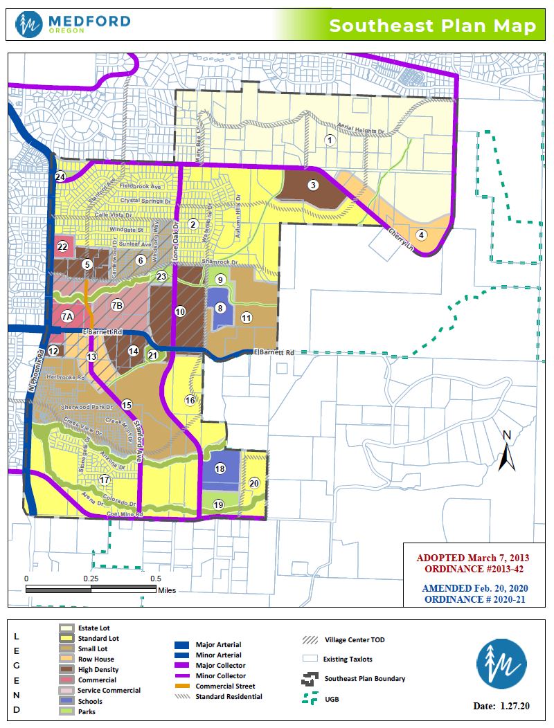
10.373 General Land Use Plan Map, Southeast Plan Map, Zoning, and Residential Density, S-E.
(1) The sub-areas, General Land Use Plan Map designations, Southeast Plan Map land use categories, zoning, and residential densities permitted in the S-E Overlay District are provided in Table 10.373. See Figures 10.373(A) and 10.373(B) for the location of Southeast Plan Map sub-areas.
(2) Special Residential Density Provisions for the S-E Overlay District.
(a) Minimum permitted residential density is 5.0 units per acre in SFR-10 for the portion(s) of a development where dwellings receive sole vehicular access from an alley.
(b) Maximum permitted residential density is 36.0 units per acre in MFR-30. Within Area 7A, residential development shall conform to Section 10.378(3).
(c) When development is proposed as a PUD larger than five acres, the residential may be increased by up to 20% in accordance with Section 10.192(7)(b).
Sub-Area | General Land Use Plan Map Designation | Southeast Plan Map Land Use Category1 | Permitted Zoning | Permitted Residential Density Range Du/Ac3 |
|---|---|---|---|---|
1 | UR | Estate Lot | SFR-2 | 0.8 to 2.0 |
2, 16, 17, and 20 | UR | Standard Lot | SFR-4 or SFR-6 | 2.5 to 6.0 |
6, 11, and 15 | UR | Small Lot | SFR-10 with alleys2 | 5.0 to 10.02 |
SFR-10 without alleys | 6.0 to 10.0 | |||
4 and 13 | UM | Rowhouse | MFR-15 | 10.0 to 15.0 |
3, 5, 10, 12, and 14 | UH | High Density | MFR-20 | 15.0 to 20.0 |
MFR-30 | 20.0 to 36.0 | |||
7A | Commercial | Commercial Center Core | C-C | 20.0 to no limit See 10.708(3) |
7B | Service Commercial | Commercial Center – Service/Office | C-S/P | 20.0 to no limit See 10.708(3) |
8 and 18 | UR | School | SFR-4 or SFR-6 | Not Applicable |
9, 19, and 21 | UR | Park | SFR-4 or SFR-6 | Not Applicable |
21 | UH | Park | MFR-20 or MFR-30 | Not Applicable |
22 | Commercial | Commercial | C-C | 20.0 to no limit |
23 | Parks and Schools | Park | P-1 | Not Applicable |
24 | Parks and Schools | Park | P-1 | Not Applicable |
See SE Plan Map | Greenway | Greenway | Any | Not Applicable |
Table Footnotes:
1 Southeast Plan Map land use categories are derived from the study entitled Southeast Medford Circulation & Development Plan, August 1995, as amended.
2 Special density provisions for SFR- 10.
3 Du/Ac = Dwelling units per acre.
Figure 10.373(A).
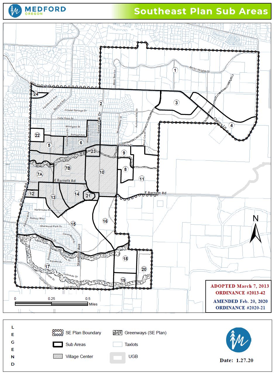
Figure 10.373(B).